
In December 2025, Canadians gained a new lifeline far beyond cellular coverage: Rogers officially launched its “Rogers Satellite” service — a national satellite-to-mobile offering powered by Starlink. This isn’t just about emergency texts anymore: with the new service, people in remote regions, wilderness zones, or on sparsely populated highways can now use their regular smartphones to get data, messaging, voice and even video-enabled apps directly over satellites.

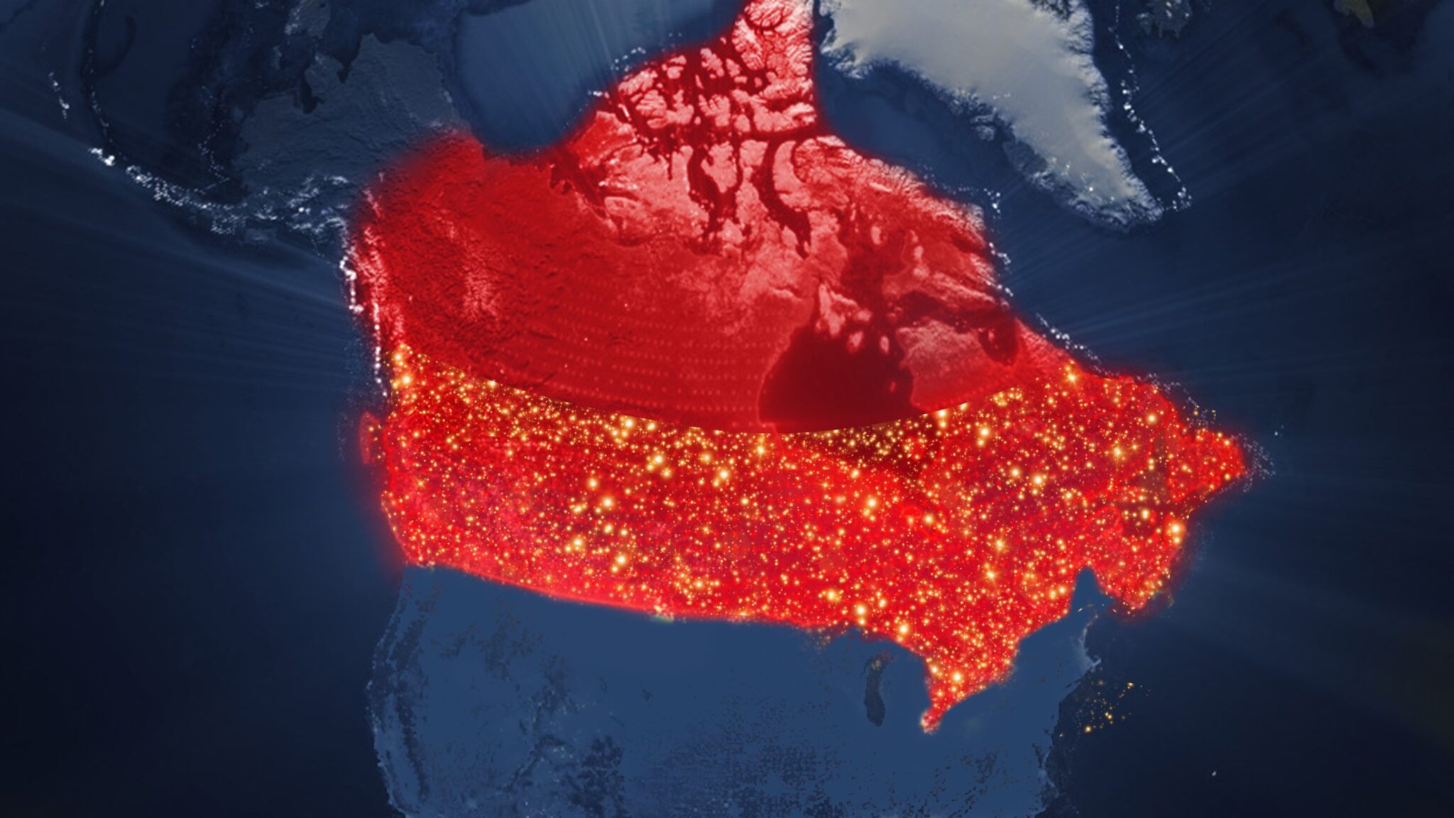
Earlier in 2025 Rogers had invited Canadians to join a free beta trial for satellite-texting, covering more than 5.4 million square kilometers — over 2.5 times the area of any traditional wireless network in Canada. That coverage was already a dramatic expansion; now the service is stepping up in capabilities. As of the official launch, apps like WhatsApp, Google Maps, AccuWeather, X (formerly Twitter), and CalTopo have been confirmed to work over satellite in supported areas.
What this means is nothing short of transformative: a smartphone can become a quasi-satellite phone, allowing hikers, boaters, campers, remote workers, and residents of rural or sparsely networked communities to call, text, navigate, share maps, check weather, or post updates — even when there’s no cell tower anywhere nearby.
For many Canadians accustomed to “no signal” in deep forests, the Rockies, northern highways or maritime routes, this service offers a real chance at inclusion. For emergency services, too — being able to text or call in situations where coverage has always been absent could be life-saving. According to Rogers, this rollout is the first nationwide satellite-to-mobile service of its kind in Canada.
Behind the scenes, the technology uses low-Earth-orbit satellites operated by Starlink, combined with Rogers’ national wireless spectrum. That means you don’t need special phones or satellite-specific hardware — just a compatible 4G/5G smartphone and a clear view of the sky.

Of course, nothing’s perfect: like all satellite services, performance still depends on sky visibility — so deep canyons, heavy forest canopy or indoor use may still disrupt the signal. And the coverage map, while huge, doesn’t yet include every remote corner of Canada. But for a country of vast wilderness, winding coastal shores, remote islands and sparsely connected territories, the launch of Rogers Satellite marks a huge step.
In a way, this partnership — combining cutting-edge satellite infrastructure with an established national carrier — shows how the future of connectivity is evolving. Not just fiber cables, cell towers or conventional internet — but a hybrid where the sky becomes part of the network, and every smartphone can be a window to the world, no matter where you roam.


Leave a comment